

Karmuwala village history
01 · HISTORY
Gharka, Karmuwala and the Beas
Karmuwala lies on the Beas, south of Amritsar, in Punjab’s Tarn Taran district. Its story begins in the fields around neighbouring Gharka, but it reaches well beyond them: to river crossings and old maps, to a First World War register of local men, and to lives made far from home. 5, 16, 18
Gharka’s own beginnings survive in more than one tradition. One tells of people coming from Buh to Gharka, and the village is also remembered as Būh wālā Ghaṛkā, “Gharka of Buh”. 25
A second tradition tells of five brothers. Two of them, Gharka and Chamba, are said to have founded the neighbouring villages; the other three are remembered as Rurka, Varnala and Ghariala. 1
Some Sandhu families from Gharka and Chamba also moved farther afield, accompanying Gulab Singh and Mehtab Singh, sons of Sardar Karam Singh, a leader of Misl Shaheedan, to a jagir in Hoshiarpur district, where the brothers settled around 1816. The family account names Pathial among the villages established after this move. 43
Village memory traces Karmuwala itself to families settling near their fields. Those whose land lay on the Dhunna side of Gharka moved closer to it. Families with land in Karmu di Patti made their homes there, while some others sold their holdings. The inhabited settlement became known as Karmuwala di Abadi, associated with Patti Karmu. Home had moved out to meet the land. 5, 18
02 · HISTORY
Crossings and neighbouring settlements
For travellers, the Beas was something to cross. In 1598, the Mughal emperor Akbar, travelling from Lahore towards Agra, crossed the river at Gobindwal on an elephant while his troops used a bridge. 2
In April 1615, two English travellers, Richard Steel and John Crowther, were passing through this river country on their way to Lahore. On the 22nd, an eleven-coss stage brought them to Chiurmul, with a boat crossing of the river they called Vian, understood as the Beas. Beside the river stood the encampment of a royal ambassador bound for Persia. Two more stages, of seventeen coss to Chan Channa Sera and seven to Lahore, completed the journey. 37
Chiurmul turns up again on European maps. Blaeu’s Atlas novus, in a volume dated 1645, marks it beside an unnamed river near Sultanpore and Can Channas. A century later, d’Anville’s map of 1751 marks the same place as Kiurmul, beside the Biah, with Fatiabad and Sultanpur nearby. Whether Chiurmul is an early form of Karmuwala remains unresolved. It is a tantalising possibility: a crossing on the Beas, named by English travellers in 1615 and drawn by mapmakers in Amsterdam and Paris, may be the earliest glimpse of the village. 38, 39
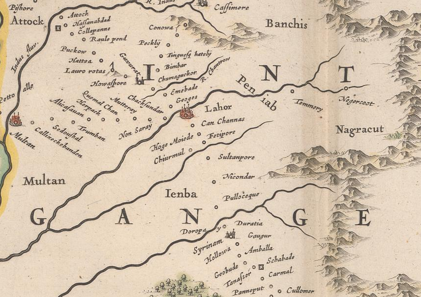
1645 atlas volume: Chiurmul beside an unnamed river, near Sultanpore and Can Channas on the approaches to Lahore.
Source and image
Blaeu, Magni Mogolis Imperivm, in Atlas novus, Pars Secunda (1645). Zentralbibliothek Zürich, T 5-8, Atl 100: c, doi:10.3931/e-rara-92289. Public Domain Mark. Detail.
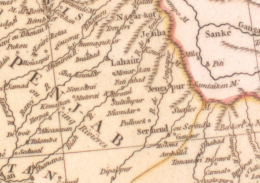
1751 map: Kiurmul beside the Biah, with Fatiabad, Sultanpur and Lahaur in the surrounding landscape.
Source and image
Jean-Baptiste Bourguignon d’Anville, Première partie de la carte d’Asie (1751), northern sheet. Universitätsbibliothek Bern, MUE Ryh 6604: 3–4, doi:10.3931/e-rara-129586. Public Domain Mark. Detail.
A contemporary news report from late 1798 may offer an early glimpse of Gharka. Shah Zaman, king of Kabul and Kandahar, was then at Lahore. The account describes how the zamindars, or landholders, of two villages, Khureaheh and Purwaheh, had carried off cattle from another village. When a complaint reached Shah Zaman, he sent a detachment against them. According to the report, both villages were destroyed, their inhabitants were “put to the sword”, and the troops returned to the army carrying plunder.
The link to Gharka comes from the historian Hari Ram Gupta. In the third volume of his History of the Sikhs, published in 1944, he drew on this report, preserved in British records now in the National Archives of India, and proposed that Khureaheh was Ghurka, twelve miles south-east of Patti, the village known today as Gharka. 35
By 1814, Gharka was on the map, though not under that name: the cartographer Aaron Arrowsmith marked it as Koorka. 13
The crossings themselves could be busy. In December 1832, at Harike, below the then confluence of the Beas and Sutlej, thirty-two boats carried loaded carts and pack animals across the river from morning until night. The observer was Lieutenant Frederick Mackeson of the 14th Native Infantry, waiting near Bhidanwala for Captain C. M. Wade’s mission party to arrive from Lahore. His journal, published in 1837, gives a sense of the traffic a single crossing on this river system could carry. 4
A survey map of 1835 brings the story closer to Karmuwala’s own neighbourhood. Here, Kheraiwalee stands beside Doom, Chubba and Cumboo, with Peepul at the river and Hurreeke farther downstream. Khereah, a different place despite the similar name, is plotted separately on the approach to Hurreeke. Kheraiwalee appears again on John Walker’s map of 1846, in a comparable position near Goorka, Walker’s spelling of Gharka. The label runs across the seam where the map’s panels were mounted and reads in full once they are joined. 17, 14
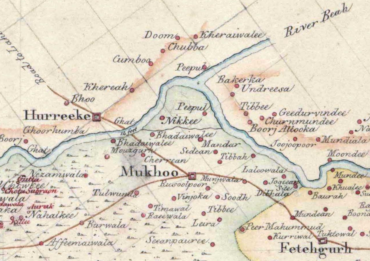
1835 map: Kheraiwalee beside Doom, Chubba and Cumboo, above Hurreeke on the Beas.
Source and image
Survey of India / National Archives of India, Map of the Country South of the Suthludj River (February 1835; copy 3 November 1835), Folio 10, Sheet 22, NAI CR_000002286564. Scan collection curated by JohnBrownFRGS, Zenodo 3596387, CC BY 4.0. Detail.
Taken together, this cluster of neighbouring places makes a connection between Kheraiwalee and Karmuwala plausible. One possibility, and it is only an interpretation, is that the older name belonged to a settlement associated with Karmuwala’s site, perhaps abandoned or re-established under another name. Set beside the village memory of families moving out to live near their fields, it leaves an open question: had people lived on this ground before it became Karmuwala? 17, 14, 18
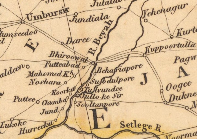
Koorka · 1814, with additions to 1816
David Rumsey Map Collection · 10498.002
Source and image
Aaron Arrowsmith, Outlines of the Countries Between Delhi and Constantinople, 1814, with additions to 1816. David Rumsey Map Collection / David Rumsey Map Center, Stanford University Libraries, 10498.002.
This unchanged map detail preserves the recorded spelling “Koorka”.
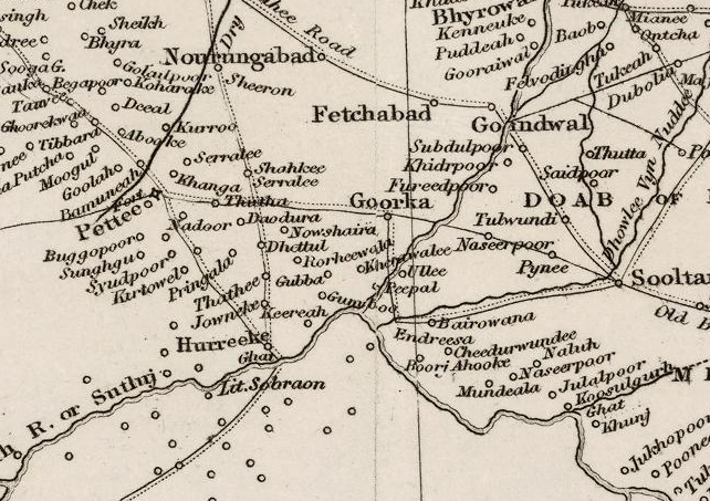
Goorka · 1846
David Rumsey Map Collection · 13305.002
Source and original scan
John Walker, published 30 March 1846. David Rumsey Map Collection, David Rumsey Map Center, Stanford University Libraries, 13305.002.
Cropped and joined display copy: the mounting gap is closed and the panels aligned; retained map labels and lines are unchanged.
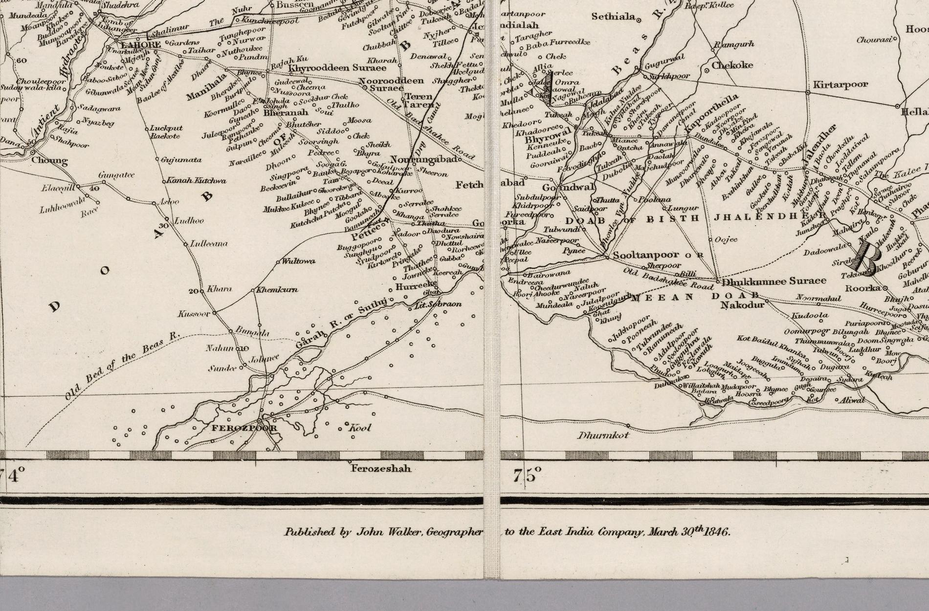
Maps shown at different scales.
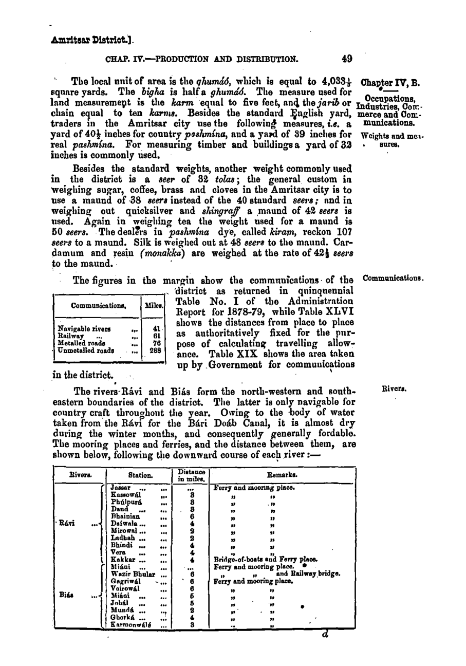
Then, in 1883–84, the name comes into focus. The Amritsar District Gazetteer lists Ghorká and Karmonwálá as successive ferry and mooring stations on the Beas, three miles apart downriver. It is the earliest secure record yet found of Karmuwala’s name in a recognisably modern form. By 1892–93, the revised gazetteer recorded four boats at Gharka’s crossing. The two places were links in a chain of river stations where boats moored and people crossed the water. 15, 26
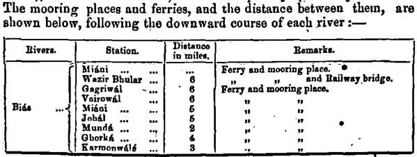
Beas river crossings, 1883–84
Source and full page
Gazetteer of the Amritsar District, 1883–84, printed page 49; digitised copy, Gokhale Institute of Politics and Economics.
Beas-only excerpt; Ravi rows are omitted. The retained table entries and numbers are unchanged.
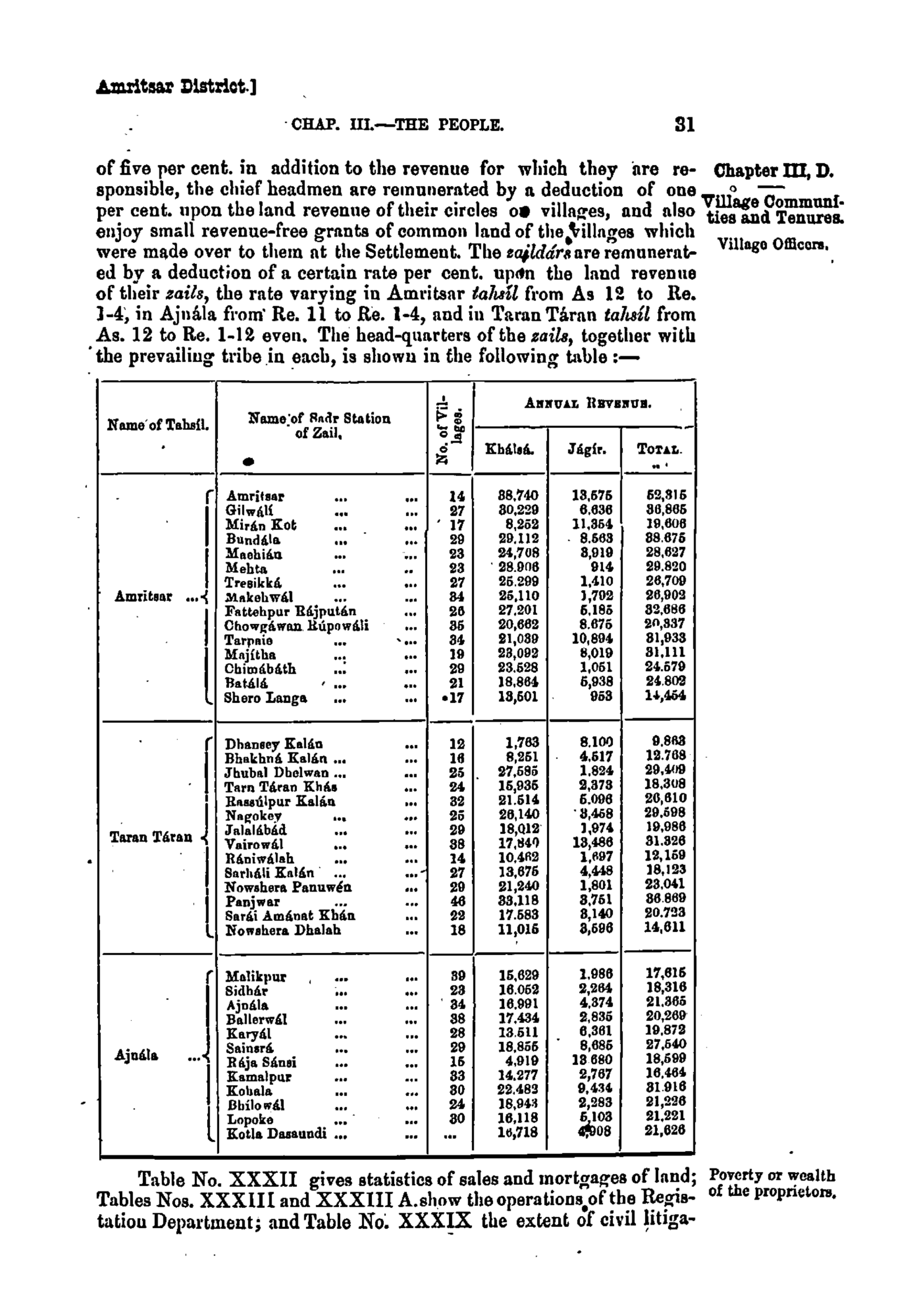
Not every connection ran along the river. Nineteenth-century gazetteers identify Raniwala, in the countryside around Gharka, as the headquarters of a zail, a group of villages served through its zaildar. The surviving First World War village register names Raniwalah as the zail of “Karmanwala near Gharka”, so when the register was compiled, Karmuwala belonged to it. 42
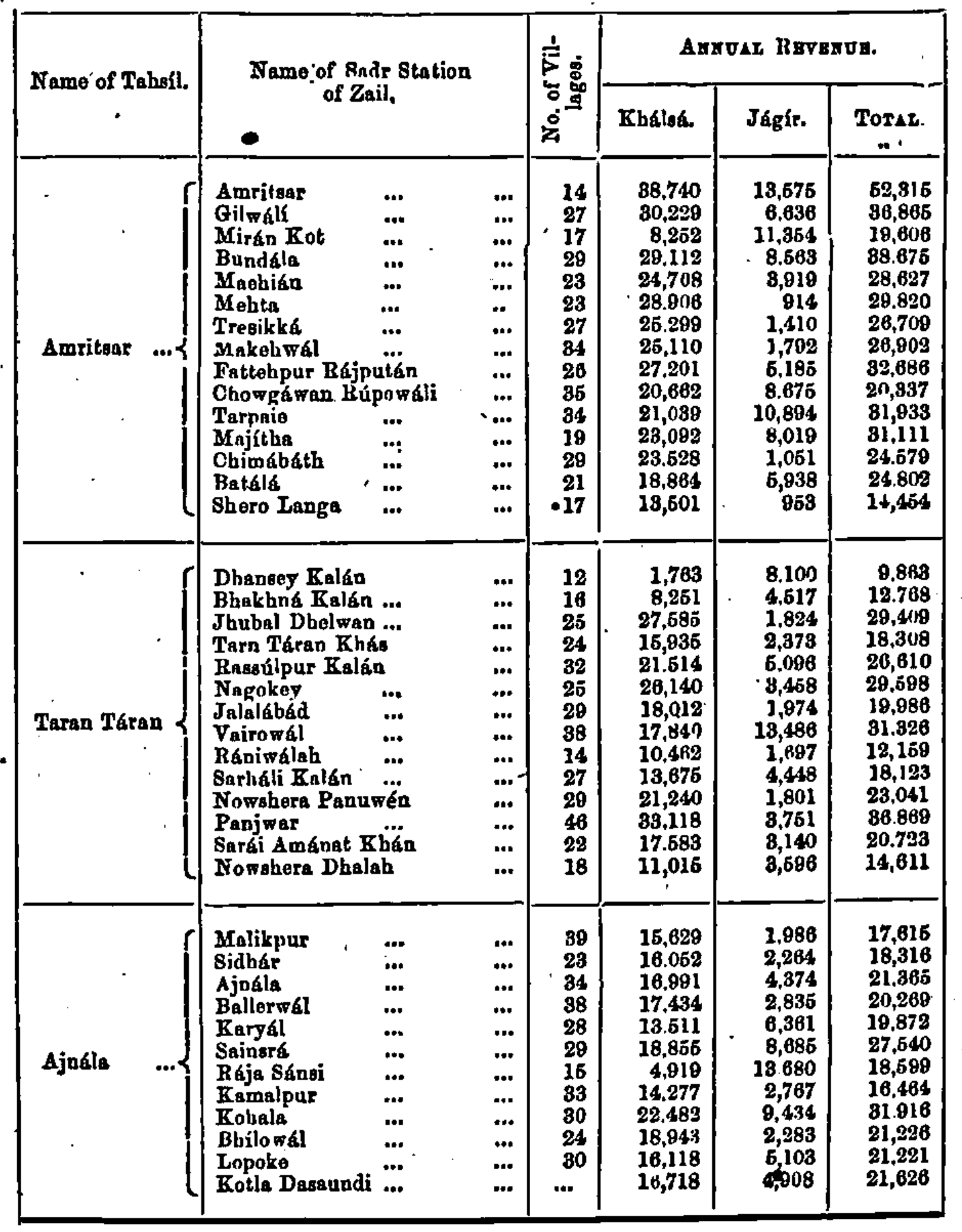
Raniwala and the zails of Amritsar, 1883–84
Gazetteer of the Amritsar District, 1883–4, p. 31. Rániwálah appears as the headquarters (Sadr Station) of a zail in Taran Táran tahsil, with 14 villages.
Source and full page
Gokhale Institute of Politics and Economics digital copy. Select the table above to enlarge the full page.
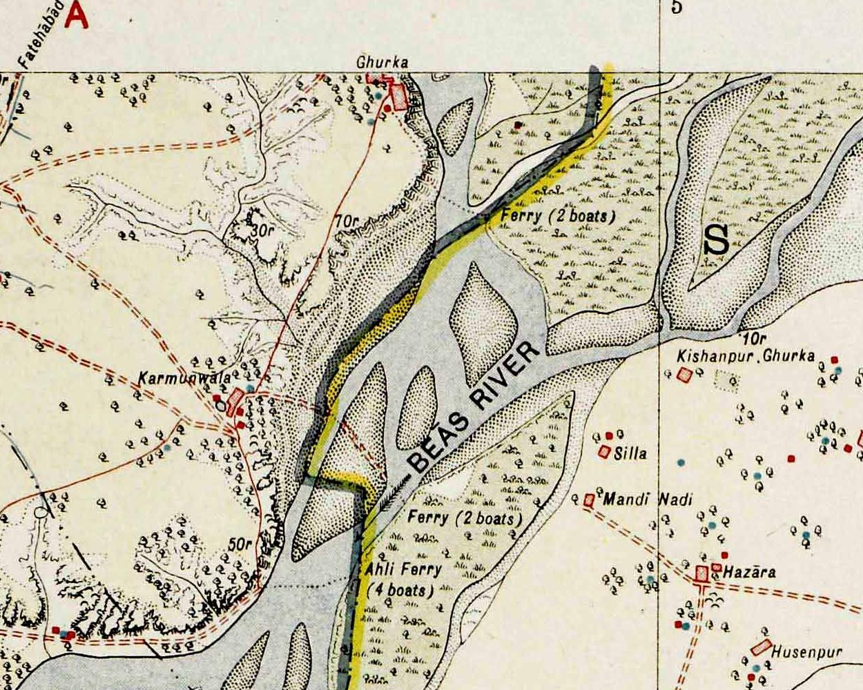
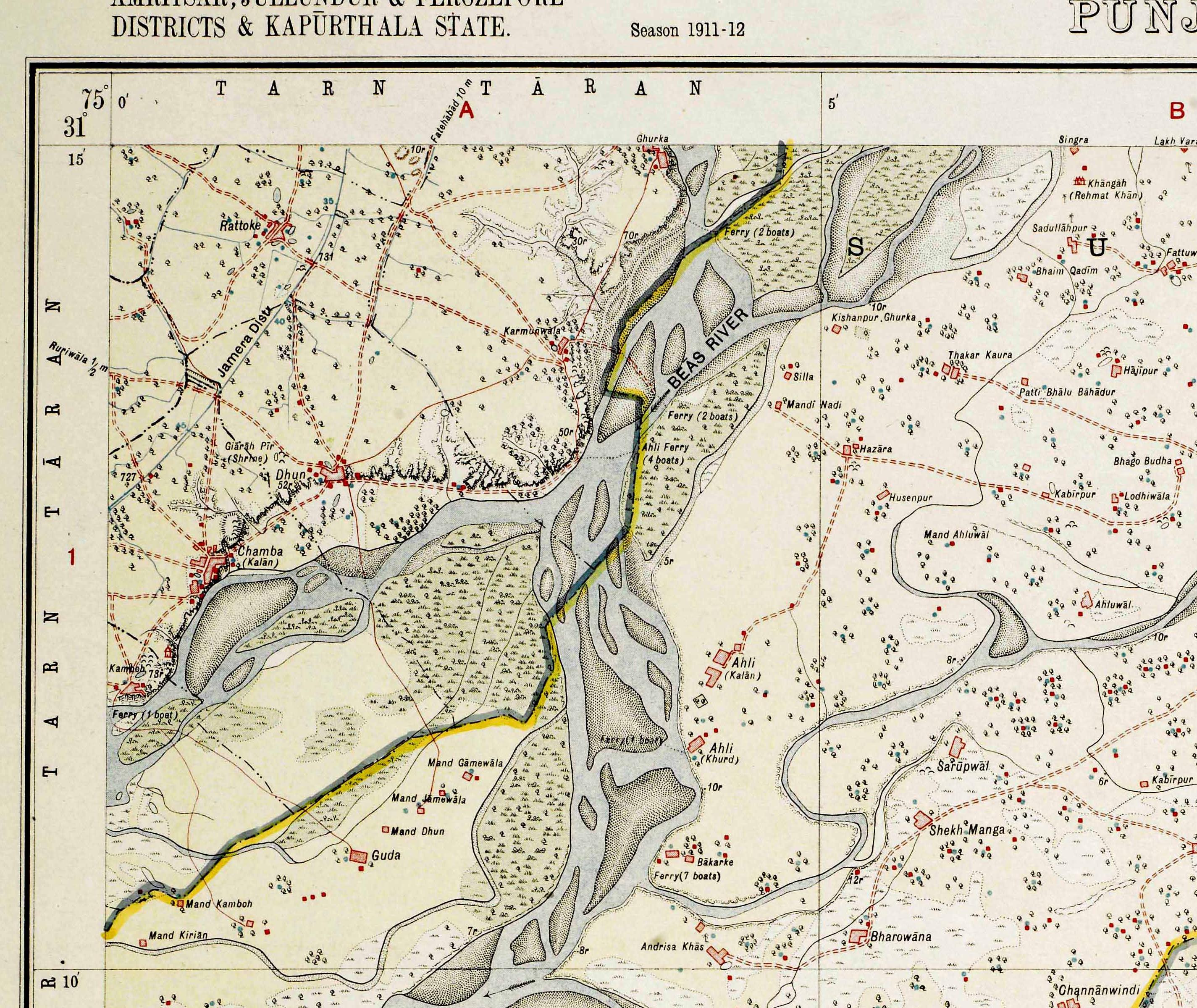
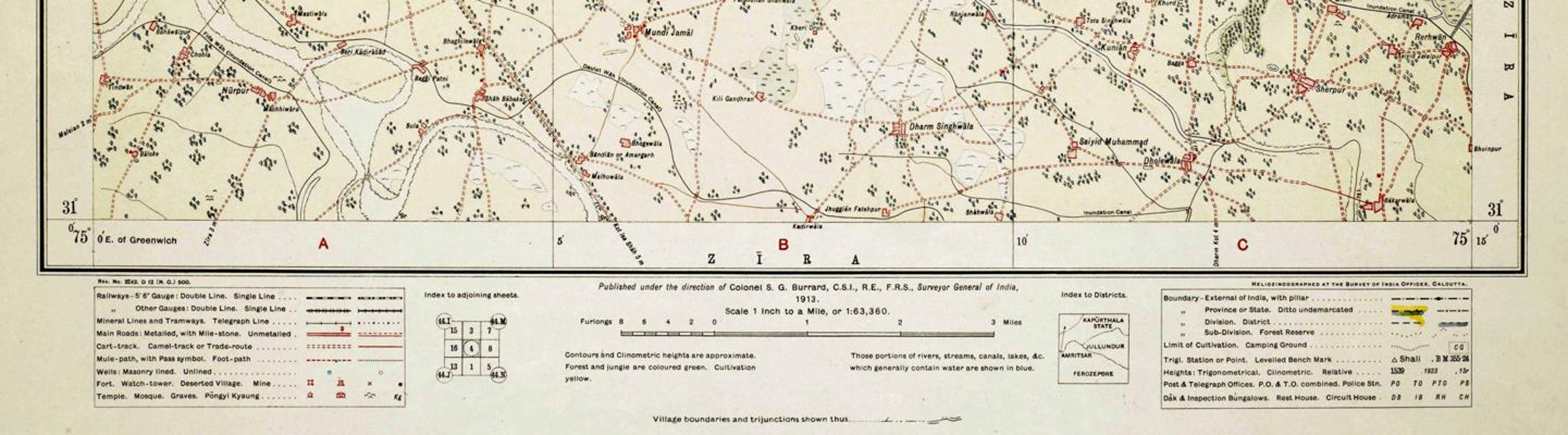
The Survey of India sheet published in 1913 brings these pieces together. It labels Karmunwala and Ghurka as separate settlements, with Dhun and Chamba Kalan to their south-west, marks ferry crossings along the river, and shows the Jamera distributary in the surrounding landscape. Village, river transport and canal irrigation now appear on a single sheet. 16
Karmunwala and Ghurka on the Beas, 1913
Source, full map and legend
Survey of India sheet 44 M/4, published in 1913 from the 1911–12 survey season. Local display crop; original map pixels are unchanged.
Survey of India; scan collection curated by John Brown, Old Survey of India Maps, Zenodo, CC BY 4.0.
03 · HISTORY
Military service and the First World War
The surviving handwritten First World War village register brings the war close to home. Thirty-one of its seventy-eight entries fall under “Karmanwala near Gharka”, most of them with a cavalry, infantry or depot designation beside a man’s name and his father’s. Bhan Singh, son of Chenda Singh, appears beside “Depot No. 3”; Kadir, son of Bura, beside “Infantry No. 3”. 41
The register’s notes are terse. Across the entries for both villages, they record pensions of five to thirty rupees a month, medals, wounds, men who left service or returned, and, against one Gharka name, “Died In The War”. These brief lines add military service to the village’s history of farming and river transport, though most of the journeys behind them remain untold. 41
Another record may carry the village’s name as far as Basra. Lance Naik Chet Singh, of the 1st Battalion, 56th Punjabi Rifles (Frontier Force), died on 2 November 1917 and is commemorated on the Basra Memorial. His family’s home is recorded as “Karmu Wala, Tarn Taran, Amritsar, Punjab”. 40

Surviving portion of the First World War village register, page 727, with entries for “Karmanwala near Gharka”. Bhan Singh’s entry is serial 7581. The register’s title and date remain unconfirmed.
Source and image
Retained reproduction: Amardeep Singh Madra / UKPHA.
Village Service Register
The image shows ten entries from the register; the table below contains the full list. 41
Search by name, entry number or remark. On phones, each name heads a card with all its labelled fields. On wider screens, scroll across the table for more columns. With the register focused, use the arrow keys to scroll.
04 · HISTORY
Land, water and work
Good water could not be taken for granted. The lower part of Tarn Taran had been known as Khára Mánjha for its brackish water; by the late nineteenth century, canal irrigation was changing cultivation and the look of this wider country. 24
Gharka’s land carried a different risk. The 1914 settlement report placed it in the Bet Bangar assessment circle and classed it as insecure for revenue purposes, reflecting the uncertainties of riverside land. 36
In village memory, farming depended above all on water, and access to it was uneven. Wells served both households and fields, and some holdings had canal irrigation. Larger holdings could have several wells, while other cultivators managed with less. Barley, taramira and chickpeas were among the crops grown. 7, 19, 20
Differences in resources showed in buildings as well as fields. Sunder Singh was a village landholder who had been in business in Singapore since 1894. In Karmuwala he was remembered for wells that served the village and its cultivated land. His family’s brick house was recalled as a tall building standing out among the mud houses, with water pumped to its upper floor. 5, 7, 9
Living beside the Beas did not make water simple. River water was used for cooking, but the river could also divide farmers from their own land: fields on the opposite bank could be reached only by a crossing, and monsoon water could damage the crop. The village’s farmland did not stop at the water’s edge, even when reaching it was hard. 20
Not everyone who worked those fields held them. In winter, labourers worked for a daily wage, while paddy work ran on seasonal contracts of varying length. Wages were settled through consultation between landholders and labourers, with the panchayat taking part. 28
Land could also be bought, or kept, with money earned far away. In the Sirhali area in the late nineteenth century, men mortgaged land while serving abroad and redeemed it from their savings on return. A later Karmuwala family memory is simpler still: “My uncle used to send money from abroad, and my father would buy land here.” 24, 27
From the late 1960s, machines changed the work. Tube wells are remembered as arriving in 1968, followed by tractors and other machinery, and early owners of machines helped their neighbours. Together with canal irrigation, these changes gave cultivators greater access to water and eased some of the labour of farming. 19, 21
Official land-use figures give a later measure of the change. The return for 2009 records 1,620 of the Gharka revenue estate’s 1,656 hectares as irrigated: 474 hectares by canal and 1,146 by wells or tube wells. The figures cover the wider Gharka estate rather than Karmuwala’s fields alone, but they describe a landscape almost entirely under irrigation. 32
Across four centuries of records, the same questions keep returning: who had water, who had to cross it, and who went far from the river to earn a living. The family histories follow some of those lives further.

